ODYSSEE left it's home dock on Sunday, September 30 and arrived in Charleston Monday afternoon. On Tuesday morning, YOUNG at HEART will leave her dock on Parrot Point Creek on James Island and meet ODYSSEE on the Cooper River,
Since leaving Charleston, until arriving at Santee State Park near Santee, SC, we've had no WiFi service.
On Tuesday we started up the river at about 10:00. The cooper river was very deep all the way up to Lake Moultrie. 35 miles up the river we came to the first bridge we needed open. To request an opening you need to call the bridge 6 hours before you get there,and then call again as you get close, so the bridge operator can drive to the bridge you want opened, he operates two bridges about 10 miles apart.

The bridge opens for us, we go through and YOUNG at HEART follows us.
 Another 10 miles up the river we arrived at Monks Corners, where we spent the night tied up to the dock at Gilligan's Restaurant, free night dockage with power if you have dinner, what a deal!
  Wednesday, we needed a second RR bridge opened just before the dam and lock at Lake Moultrie. The same bridge tender arrived to do the honors. As the bridge goes up we can see the 80 foot high dam and lock. We call the lock master and proceed to the lock door. These bridges and lock have no VHF radios so all communication is by cell phone. When this lock was built back in 1939 it was the highest single chamber lock in the world at 75'.
 Once in the lock, we tied up to a floating dock that was secured to the locks bollards. YOUNG at HEART rafted up to us and we started up. the lock was very friendly with little turbulence as we went up.
Gotta go! Today is Friday, we're going to see how far up the Congaree River today. Will fill in details later.
It's Saturday afternoon, and we're back a Santee State Park, so back to some details!
 Once to the top of the 75' lift we can see Lake Moultrie off to the NW. Once on the lake there is a 6 mile buoyed straight channel to diversion channel which connects Lake Moultrie and Monroe. Parts of Moultrie are 90' deep, and when the lake was flooded they flooded over roads, bridges, and towns, all of that stuff still down there.
 YOUNG at HEART lead the way out of the lock and across the lake, and enters diversion channel leading into Lake Monroe. Lake Monroe is not as deep as Moultrie, and they never cleaned all of the trees out before they flooded, so there are trees and stumps all over, it's important to stay in the buoyed channel.
 Here's an eagle sitting on one of the many deadheads.
 Thursday morning was overcast and drizzly. We continued up the lake with the intention to get to Santee State Park. About halfway up the lake we go under Interstate 95. At this point the lake was getting shallow except for the old Santee River bed, which winds all over between the trees that continue to stand. Here YOUNG at HEART follows us through the maze.
We anchored in a nice cove behind Santee State Park.
 Friday we set out to see how far we could get up the Santee River and then up the Congaree River. As we approached the far west end of Lake Monroe, the channel got narrow and shallow, with lots of growth crowding in on the channel. We found the deepest water on the outside of the river bends and we hugged the growth close.

 The water was very skinny, running between 6-8'. It look like we wouldn't be able to get through, but the bottom was very soft mud and many had told us we could get quite a ways up the river, so we slowly continued. They were right, within a few miles the river became a typical river, with a downstream current of 1.5 to 2 MPH, with depths along the deep channel of 12-18'. We knew there were three bridges to get under, the first a RR bridge with a reported clearance of 18'. The water is down about 1.5', and we found about 20' clearance. A little further upstream the Santee River ends and the Wateree goes off to the north and the Congaree goes off to the west towards Columbia. We turned left up the Congaree and soon found the second bridge, highway 601, with a new span under construction.
 About 3 miles further up the river we came to the third bridge, with an 18' clearance per the chart. Well, this bridge was also under construction and a temporary span was across the river for the crawler cranes to use. One of the construction guys stretched his tap measure down to the water and announced the clearance was about 15'. We may have been able to get under, but YOUNG at HEART could not, so we decided we were as far as we were going.
 We turn around and went back down the river about a mile where there was a nice sand bar to anchor off of. We launched YOUNG at HEART's dingy and went back up the river for about 5 miles, to where Cedar Creek entered the river from the Congaree National Park. My Garmin Nuvi said we were where the creek came in, but it was getting dark and we never found the creek. So back down the river to the boats for the evening.
Saturday we worked our way back down the river to the anchorage we had used at Santee State Park. As we approached our turn off from the channel to go into the park some paddle boards crossed our bow.

We decided to just relax and enjoy the Santee State Park facilities on Sunday. Sunday morning we went over to Poplar Creek Landing Cafe for a late breakfast. We came back to the park and took a bike ride on their 7.5 mile bike trail. Done riding and tired, we went back to Poplar Creek Landing for an early dinner.
 Chuck comes into the Poplar Creek harbor to join others for dinner. That's his fold up bike in the dingy.
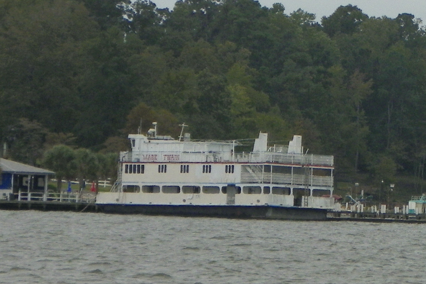

Monday morning was cold and drizzly. We left to get to the east end of Lake Monroe at the entrance to Diversion Canal that connects the two lakes. Along the way we passed the MARK TWAIN, docked in Miles Creek Landing.
As we approached the east end of the Lake we saw one boat of hardy fishermen.
We anchored for the night behind Chimney Island.
 Tuesday morning we awoke to a lake with lots of steam being blown across the surface, It looked like blizzard blowing snow across the North Dakota prairies.
I dove the boat to change out the props and put on the spares we always carry with us. When coming back down the Congaree River, following the "crumb" line we had laid down on our GPS Chartplotter, we hit a submerged dead head. We knew there was lots of water logged logs under the water in the west end of Lake Monroe, the Santee River, and the Congaree River. We expect that on the way up the river we disturbed the bottom enough with two large boats turning 4 propellers to dislodge one of these logs. Coming back down on the same course we had used on the way up led us over that submerged log, now only 3' or so below the surface. On Monday we noticed a vibration at about 1150 RPM, so we knew there was some prop damage. It took me about 2 hours to change out both props. At 11:30 we were on our way east bound down Diversion Canal.

 At 1:50 PM we were at the east end of Lake Moultrie entering the lock. At the bottom of the 75' drop the large lock doors open and we drive out into the Cooper River.
 At 2:40 PM we tied up the boats at Gilligan's dock in Monks Corner. We launched YOUNG at HEART's dingy and went a little further down the river to the Old Santee Canal Park. The Heritage Center at the park presents the history of the early canal systems used in South Carolina back before the Civil War. The Santee Canal was the oldest canal in the US, now buried under Lake Moultrie. We only had an hour to look around, not near enough time. The entrance is a mock up of a lock chamber with a set of lock doors at the entrance.
 We returned to the boats at 5:30, cocktail hour on ODYSSEE and dinner at Gilligan's.
 Wednesday morning we started out for our trip down the Cooper back to Charleston. The tide was falling so along with the natural flow of the river we had a 2 MPH push. One last wave to the bridge tender who had raised both RR bridges two times each, we got to know him pretty well!
A big smile from Brenda and Glenn on YOUNG at HEART.
 The busy Charleston Harbor comes into view, a very busy place.
 The beautiful Ravenal Bridge spans the Cooper River at the entrance of the upper Charleston Harbor.
We ran some errands Thursday morning in Charleston, then left about noon to head south down the ICW. We anchored in Tom Point Creek for the night, about half way between Charleston and Beaufort. We completed the trip home Friday, on a beautiful day to cruise. The beauty of the day was disturbed three times by being waked by idiots driving large production cruisers with no understanding of how disruptive their wakes are.