Monday, September 28, 2009
Homeward Bound
The easterly wind continued to blow strong on Sunday and it rained much of the day. We enjoyed a noon meal with our nephew and his wife. The forecast for Monday indicated a period before 11:00 where the wind would be moderate from the WSW, but after 11:00 it was suppose to pick up to 25-30 from the south. If we were going to be able to use the day, we would have to run outside to get to Manasquan before 11:00 and then run down the New Jersey ICW in the shelter of the barrier islands. Looked like a plan!
We were up early, recheck the forecast on the computer, look at the conditions outside, and make a final decision. Things looked like our plan of yesterday would work. We cast off from the dock at 6:40 and headed across Lower Bay and around Sandy Hook. The sea conditions were delightful, a lazy swell with just a small ripple on top. At 10:30 we turned into Manasquan Inlet, stopped for some fuel, and started down the inside route. By 11:30 the wind was blowing 25-30 from the south, and the waters of the inside route were choppy, especially Barnagat Bay. The 3' chop was not any challenge for the boat, but as soon as the bow kicked up the water, the wind made sure we gave the boat a good salt water bath. One more time we were glad to be under a hard top and behind a windshield, nice and dry. We finished the day in Beach haven, NJ, logging on 83 miles for the day. We got in about an hour before the next cold front came through, bringing some showers and a blast of wing from the NNW. So we even got the boat rinsed off. Now I call that planning!
The wind forecast was WSW, 20-25 for Tuesday. Our plan was to run inside down to Cape May. The wind was SW, 20-25 when we woke up. We got underway at 8:55. The run was 71 miles, winding through the back side of several beach front communities, Atlantic City, Ocean City, Stone Harbor, and Wildwood, under several draw bridges, some we could just squeeze under and others we had to have open for us. We arrived at Miss Chris Marina at 5:45 and were put in a slip next to another looper boat from Beaufort, SC. Small world. At the end of the day the wind did back around to the West.
Wind was forecast to be lighter on Wednesday from the WNW, but we were starting up Delaware Bay and any NW wind has a long fetch down the bay, generally resulting in some serious waves. The Bay is also tidal with a normal current of 1.5 each way. I figured if we waited until after the max ebb, we would still have enough tidal flow to reduce the wave, and by the time we got up the bay about 30 miles into the narrower section, the waves would be smaller and if we timed it right the tidal flow would change and we would get a push for the last part of the run up to the C & D Canal. Well, I maybe over engineered the run, I didn't consider all the rain they have had which resulted in a much stronger ebb flow than normal, in fact twice as strong as normal and I expect there may not be any flood up higher in the river. Consequently we ran against a 2.5-3 MPH current all the way to the C & D Canal, and some 3-4 foot waves on the nose for the first 25 miles or so. We put ODYSSEE up onto a plane, going through the water at 16 MPH but only making 13.2 MPH or so over the ground. We spent a lot of energy to put 72 miles under our keel getting to Chesapeake City for the night.
On Thursday we left Chesapeake City at 8:30. Back on the C&D Canal at slack water. Within 30 minutes, we started getting a push, and we got a push all the way to Kent Narrows on our way to visit with my sister and brother-in-law in St. Michael's, MD. The wind in the upper Chesapeake were quite strong, on the side, much more than forecast. To smooth out the ride we put ODYSSEE up on a plane for two hours until the wind died and we turned to the SE into Kent Narrows. The rest of the ride was very pleasant and we arrived at my sister's dock at 4:20.
After a delightful weekend in St. Micheal's, we pushed off again south bound on Monday, October 5. We arrived in the Solomons to have dinner with our "Looper" friends on their boat LAGRACE. Spent Tuesday at the Spring Cove Marina and were joined by other "Looper" friends. After sundowners on ODYSSEE we all went to the marina restaurant for their Tuesday special, two dinners for $21.00. It was blowing gale force winds on Wednesday, so we laid low in the harbor, but did move to an anchorage so we could make an early departure on Thursday.
The wind died all day Thursday. We had the wind and waves on our stern so the remaining wind and sea during the morning were tolerable. By mid afternoon the wind was light and variable. We were able to get all the way to Yorktown where we will spend a couple of days visiting Willamsburg and other historic sits in the area. We are on a mooring ball at Riverwalk Marina right in the new village at Yorktown.
The National Park system operates buses throughout the "Historic Triangle". Yorktown, Williamsburg, and Jamestown operate shuttle buses around the three individual sites. All buses are free. So we could pick up the 9:30 bus from Yorktown to Williamsburg, and spend all day in Williamsburg, or we could transfer and go to Jamestown. The only hitch, we had to be on the last bus from Williamsburg back to Yorktown at 3:30. In three days we were able to see all we wanted to see at all three sites. Jamestown is by far the most interesting from an historical point of view, it is the birthplace of our country, and as they continue to dig on the archaeological site continue to discover and confirm the history of 1607.
We left Yorktown at 4:15 PM on Sunday, October 11 and spent the night at the downtown marina in Hampton. Monday morning we met looper friends for breakfast, did some provisioning, and left for Portsmouth at 11:15. We fueled up and pumped out the holding tanks before tieing up to the free docks at Portsmouth.
Tuesday morning we left at 8:30 to head south down the Dismal Swamp canal. The bridges across the ICW have restricked openings before 8:30 and the second lock opening at the begining of the canal is at 11:00, so no reason to start out too early. Tuesday was a delightful day and it was very relaxing gliding through the canal at 6 MPH. We made it to Elizabeth City by 6:30 that evening and tied up to the free docks.
The weather was predicted to get rainy and windy from the north for the next few days. We are 150 miles from Morehead City where we plan on meeting our son and his family for the weekend. Two 75 mile days would get us there Thursday evening. On Wednesday we ran 77 miles to an anchorage on the Pungo River east of Bellhaven and on Thursday we ran 75 miles to the Morehead City Town Docks where we are tied up.
Will, Nancy, and our two grand kids arrived at the boat at 8:15 Friday night. We all settled into the boat for the night with a plan to go to Cape Lookout bite on Saturday for the afternoon and anchor for the night. Saturday morning the wind was blowing hard from the NW, it was drizzling, and it was chilly. It was about 11:00 when we left the dock in Morehead City for the 15 mile cruise to the bite. The channels in the bite and Core Sound are affected by every storm so there are no good charts. The Channel buoys are constantly moved to reflect the changing water levels. We poked our way east of the channel to a spot near the light house and dropped the anchor. We launched the dingy with the intention of rowing everyone ashore. On the second trip back to the boat both oar locks broke and we had to fashion oar locks from rope. By now the wind had increased and getting back to ODYSSEE was difficult. With everybody ashore, we walked across Cape Lookout to the Atlantic beach, did some shelling, flew a kite we had brought with us, and walked to the lighthouse. The wind was still blowing as the late afternoon came upon us. It was going to be difficult to get everybody back to ODYSSEE with our makeshift oar locks. There is a ferry dock at the lighthouse, so I went to talk with the ranger to see if we could have permission to bring ODYSSEE into their dock to pick up our passengers, and if so how much water was at the end of the dock. Permission was granted, and with the high tide we would have, we should find at least 6' of water. Will and I went back to take the dingy out to ODYSSEE while the others waited at the lighthouse dock. The rangers guesstimate of 6' was confirmed and we slowly brought ODYSSEE into their dock which is designed to handle 18' outboard ferry boats. Mission accomplished, we moved over to the SW corner of the bite to anchor for the night. We set two anchors at high tide with a flood tide and the wind both from the west. The anchors set well in the sand bottom, but with the high wind we left a 1/10 scope in the anchor lines. At about 11:30PM the wind died some and the ebb tide current became the strongest force on the boat. With the angle of the boat to the wind, the reverse current took the boat south towards shore. At 12:25 AM we were awakened by the bump of the boat hitting bottom. Will and I went to the drive station and turned on the depth sounder and chart plotter. The depth read 3.3 ft and the chartplotter showed we had moved about 200 ft. from our original anchoring position. We checked the tide table, low was forecast to be 12:28 AM at -0.1 ft. So in just a few minutes we would go through low, the current would turn to flood, and by 1:15 or so we would have an addition 4-6" of water which, with the current change, we should float and end up at our original position. At 1:20 AM the boat floated free and within about two minutes the boat was back in 29 ft. of water. The tide would be high at 7:33 AM and the current would reverse again shortly thereafter. So we were up at 6:30 AM, and had the anchosr up by 7:00 AM and on our way back to Morehead City. The wind was still blowing and it was chilly so we went back to our dock at Morehead City Docks, plugged in the boat, turned on the heat, and had a nice breakfast. We played Monopoly the rest of the morning, went to Atlantic Beach for a late lunch, and said goodbye to the Gorgen's at 3:30.
We left Monday morning for home, pretty much in delivery mode. We had two bridges that opened on a schedule that dictated our schedule. We timed the bridges perfectly, having only to slow down for the second bridge. We traveled 93 miles and anchored behind Carolina Beach near Wilmington, NC. If we can keep up this pace we can be home next Thursday afternoon. It will be nice to get home, it's been a long, grueling trip.
Tuesday we were unable to do as well as Monday. The pontoon bridge at sunset Beach only opens on the hour and we timed our morning to be at the bridge for the 1:00 PM opening. A little further down the waterway we went through Myrtle Beach, with a 1-1 1/2 current against us. Between all the "no wake" zones and the current, we only logged in 88 miles today. On Wednesday we will get to the Charleston area, and with luck, get home late Thursday afternoon.
We anchored Wednesday night in the Stono river just south of Elliot Cut. The weather was very nice today, sunny with a high temperature of 76, light SW wind. We travelled 92 miles today, averaging 9.1 MPH speed over ground while going through the water at 9.7 MPH most of the time. Again we pushed water more than we got a push.
We have 76 miles left to our dock. We pulled up the anchors, yes we used two because of the reversing tidal current in the Stono River, at 8:00 for the last leg of our journey. As we approached Beaufort, the tide was high so we were asble to take two short cuts, taking 5 miles off the day. As we had done when we finished the Great Loop, we strung all the courtesy flags from the states, countries, and provinces we had passed through in the order of our trip, from the bow rail to the cross arm on the signal mast, and flew these flags as we approached the end of our day. In all her glory, we tied ODYSSEE up at our dock at 3:55, a journey complete and safely at home. We logged 6096 miles under our keel since ODYSSEE was last tied up in front of our house. WOW, what an odyssey.
Wednesday, September 16, 2009
On to NYC
We left Ports mouth, NH on Sunday, September 13, after a wonderful visit with our friends from GOLD WATCH, and went south along the New H
 ampshire coast to Ipswich, MA to visit with our friends from MASCOT. Mary and Scott were in their boat at the harbor entrance to guide us in to their Yacht club and a mooring ball for the night. We spent the afternoon driving around Ipswich and a walk on the beach, then back to their house for a wonderful dinner.

 Up Monday morning, and a check on the computer for e-mail messages and the weather report. An e-mail was there from HAPPY CLAMZ informing us that they would be in Sandwich tonight with JUST RELAX and VOYAGER II. S0 why don't we go to Sandwich as well, so we did. We took the Cape Ann Canel to Gloucester, down through
  Massachusetts Bay to Cape Cod Bay and into Sandwich Harbor at the northern entrance to Cape Cod Canel. Had a nice dinner with the other three boat crews and another looper couple who live in Sandwich.
 Tuesday we all went our seperate ways. We went east along Cap Cod to Dennis to meet dear friends and former boss from my days working in Boston. Art and Mary Ann came to the marina to pick us up, have lunch together, and spend the afternoon at their Cap home.
 Wednesda
 y found us heading back west, through the Cape Cod Canal, through Woods Hole, and back east to Hyannis. As the day wore on, the wind kept building from the NE, and the waves got bigger. They were a good 4-5' as we entered the harbor at Hyannis, glad to be in out of rocking and rolling.
We were up early Thursday and on our way to th
y found us heading back west, through the Cape Cod Canal, through Woods Hole, and back east to Hyannis. As the day wore on, the wind kept building from the NE, and the waves got bigger. They were a good 4-5' as we entered the harbor at Hyannis, glad to be in out of rocking and rolling.
We were up early Thursday and on our way to th e ferry dock, on our fold up bikes, by 7:35. The first high speed ferry left at 8:00. We arrived at the ferry dock, baught our
  tickets, folded up the bikes and carried them on as baggage, and we were off for Nantucket. On the way out of the harbor we passed ODYSSEE docked between the 60 foot plus sport fishing boats. The one to the left is a new Hatteras. This boat cruises just under 40 Kts, so the trip, dock to dock is just an hour. Out in Nantucket sound the wind was blowing a good 25 and the waves were 5-6', a good day not to be on our own boat. Upon arrival, put the bikes back together, and spend the day touring the island. We were back at the ferry landing at 5:00 to take the last slow ferry back to Hyannis, getting back to the mainland at 8:30.
The weather forcast for Friday was moderate winds from the SW in the morning with 1-2' seas, building to 3' in the afternoon. We decided to head out and see how far west we could get before the waves got uncomfortable. We pocked our nose out of the harbor at 8:30 and it was already blowing 20. The waves weren't too bad yet because the tideal current and the wind were the same direction, but every wave we hit put a load of spray in our face. We put ODYSSEE up onto a plane and headed west. By 9:00 the wind was up to 25 and the waves were approaching 3', still manageable b
tickets, folded up the bikes and carried them on as baggage, and we were off for Nantucket. On the way out of the harbor we passed ODYSSEE docked between the 60 foot plus sport fishing boats. The one to the left is a new Hatteras. This boat cruises just under 40 Kts, so the trip, dock to dock is just an hour. Out in Nantucket sound the wind was blowing a good 25 and the waves were 5-6', a good day not to be on our own boat. Upon arrival, put the bikes back together, and spend the day touring the island. We were back at the ferry landing at 5:00 to take the last slow ferry back to Hyannis, getting back to the mainland at 8:30.
The weather forcast for Friday was moderate winds from the SW in the morning with 1-2' seas, building to 3' in the afternoon. We decided to head out and see how far west we could get before the waves got uncomfortable. We pocked our nose out of the harbor at 8:30 and it was already blowing 20. The waves weren't too bad yet because the tideal current and the wind were the same direction, but every wave we hit put a load of spray in our face. We put ODYSSEE up onto a plane and headed west. By 9:00 the wind was up to 25 and the waves were approaching 3', still manageable b ut very wet. Sure is nice to have a windshield and wipers. It was obvious that things would get progressively worse as the wind continued to blow and the tideal current turned against the wind. So we bailed at Falmouth at about 10:30, tied up at the city marina, and washed the boat down. A cold front came through Friday night, the wind switched to the NW and continued to blow 20-25 Saturday morning, slowely dieing as the day went on. We decided to wait until Sunday before we move. We spend the day biking to Woods Hole.
It's Sunday, September 20, and the weather is as forcast, light winds, calm seas, and sunny. Our plan is to move to the Newport, RI area with a stop at Cuttyhunk. The current situation was against us early in the day, so we elected to leave about 10:30 so we would get as much push as possible. We got to Cuttyhunk at about 1:00, went into the harbor, turned around, and left again. Stopping was going to be a bit of an ordeal and take at least an hour to just get in and out again, before we even started walking around. So back on our heading towards Newport. They have had their annual boat show going on this weekend and on Tuesday the 12-Meter World Championships start with at least 25 12's here, so we weren't sure we could even find a place to stop. We had an anchorage in the Sakonnet River if nothing else worked. We did f
ut very wet. Sure is nice to have a windshield and wipers. It was obvious that things would get progressively worse as the wind continued to blow and the tideal current turned against the wind. So we bailed at Falmouth at about 10:30, tied up at the city marina, and washed the boat down. A cold front came through Friday night, the wind switched to the NW and continued to blow 20-25 Saturday morning, slowely dieing as the day went on. We decided to wait until Sunday before we move. We spend the day biking to Woods Hole.
It's Sunday, September 20, and the weather is as forcast, light winds, calm seas, and sunny. Our plan is to move to the Newport, RI area with a stop at Cuttyhunk. The current situation was against us early in the day, so we elected to leave about 10:30 so we would get as much push as possible. We got to Cuttyhunk at about 1:00, went into the harbor, turned around, and left again. Stopping was going to be a bit of an ordeal and take at least an hour to just get in and out again, before we even started walking around. So back on our heading towards Newport. They have had their annual boat show going on this weekend and on Tuesday the 12-Meter World Championships start with at least 25 12's here, so we weren't sure we could even find a place to stop. We had an anchorage in the Sakonnet River if nothing else worked. We did f ind a spot on a floating anchored dock in Brenton Cove, and that is where we are spending the night.
 On Monday we were up early, bikes in the dingy, and off to town at 8:15. The annual boat show was packing up and the 12-meter boats were moving in. Saw the historic sites, walked part of the "cliff walk", and saw a few 12-Meter boats tunning up. Back to the boat at 4:00, bikes back to the boat in the dingy, and on our way to Point Judith for a night on the hook.
 We pulled up the anchor and were underway by 8:00, headed for Block Island. We went into The Great Salt Pond New Harbor, picked up a town mooring ball, lowered the dingy, loaded in the bikes, and went into the dingy dock. Bikes were assembled and we were off to see the island by 11:15. Before lunch we biked out to the South East Light House, the highest light on the east coast. 16 years ago the lighthouse and lighthouse keepers quarters were moved back from the cliff for fear the structure was going to colapse with the cliff into the sea, preserving the structure as a National Landmark. Back to town for lunch and ice cream, some more looking around, and then back to the marina about 4:30, ready to go back to the boat.
Wednesday we planned on meeting one of Claria's college classmates and her husband who live in East Haddam, CT. The original plan was to meet Kari in Mystic, but the only reasonable priced marina was full with boats being pulled for winter storage. We also had an oportunity to use another boating friends mooring ball in the Niantic River, but we weren't sure how we would get to shore from that mooring ball. We called Brian and Jan to ask where to take our dingy in and found they were only about 4 hours behind us and would be getting into the Niantic Bay Yacht Club later in the afternoon, and why don't we go into the Yacht Club, pick up a mooring ball there, and have Kari meet us at the YC. So that is what we did. Plans can sure change in a hurry! We had a nice visit and dinner at Kari and Phil's home.
Finding out that Brian and Jan would be at the Niantic Bay YC on Thursday, we delayed our departure so we could have lunch together, which we did. We had a nice lunch after toasting their succesful completion of the Down East Circle Loop. They will only be home for about three weeks and then will head south in their boat to the Bahamas for the winter. We will see them in November as they pass through Beaufort on their way south. After lunch we traveled west about 30 miles to the Thimble Islands where we anchored for the night.
On Friday morning the wind was blowing strong from the NNE, creating a 3-4' wave on Long Island Sound. We were headed to Port Jefferson. As we left our anchorage we hugged the north shore for several miles until our course to Port Jefferson was SW, putting the waves on our starboard stern corner, and a manageable ride across the sound. We enjoyed an evening with our looper friend from TIME OUT.
By Saturday the wind had rotated to the east, so as we headed out to New York City the waves were again to our stern. At 3:15 PM we crossed our "crumb line" under the Varrazano Narrows Bridge at the entrance to the New York Harbor, completing the Down East Circle Loop trip. We traveled 4123 miles since leaving New York City heading north up the Hudson River in June of 2008.
We pulled up the anchor and were underway by 8:00, headed for Block Island. We went into The Great Salt Pond New Harbor, picked up a town mooring ball, lowered the dingy, loaded in the bikes, and went into the dingy dock. Bikes were assembled and we were off to see the island by 11:15. Before lunch we biked out to the South East Light House, the highest light on the east coast. 16 years ago the lighthouse and lighthouse keepers quarters were moved back from the cliff for fear the structure was going to colapse with the cliff into the sea, preserving the structure as a National Landmark. Back to town for lunch and ice cream, some more looking around, and then back to the marina about 4:30, ready to go back to the boat.
Wednesday we planned on meeting one of Claria's college classmates and her husband who live in East Haddam, CT. The original plan was to meet Kari in Mystic, but the only reasonable priced marina was full with boats being pulled for winter storage. We also had an oportunity to use another boating friends mooring ball in the Niantic River, but we weren't sure how we would get to shore from that mooring ball. We called Brian and Jan to ask where to take our dingy in and found they were only about 4 hours behind us and would be getting into the Niantic Bay Yacht Club later in the afternoon, and why don't we go into the Yacht Club, pick up a mooring ball there, and have Kari meet us at the YC. So that is what we did. Plans can sure change in a hurry! We had a nice visit and dinner at Kari and Phil's home.
Finding out that Brian and Jan would be at the Niantic Bay YC on Thursday, we delayed our departure so we could have lunch together, which we did. We had a nice lunch after toasting their succesful completion of the Down East Circle Loop. They will only be home for about three weeks and then will head south in their boat to the Bahamas for the winter. We will see them in November as they pass through Beaufort on their way south. After lunch we traveled west about 30 miles to the Thimble Islands where we anchored for the night.
On Friday morning the wind was blowing strong from the NNE, creating a 3-4' wave on Long Island Sound. We were headed to Port Jefferson. As we left our anchorage we hugged the north shore for several miles until our course to Port Jefferson was SW, putting the waves on our starboard stern corner, and a manageable ride across the sound. We enjoyed an evening with our looper friend from TIME OUT.
By Saturday the wind had rotated to the east, so as we headed out to New York City the waves were again to our stern. At 3:15 PM we crossed our "crumb line" under the Varrazano Narrows Bridge at the entrance to the New York Harbor, completing the Down East Circle Loop trip. We traveled 4123 miles since leaving New York City heading north up the Hudson River in June of 2008.
 mouth, NH on Sunday, September 13, after a wonderful visit with our friends from GOLD WATCH, and went south along the New H
 ampshire coast to Ipswich, MA to visit with our friends from MASCOT. Mary and Scott were in their boat at the harbor entrance to guide us in to their Yacht club and a mooring ball for the night. We spent the afternoon driving around Ipswich and a walk on the beach, then back to their house for a wonderful dinner.

 Up Monday morning, and a check on the computer for e-mail messages and the weather report. An e-mail was there from HAPPY CLAMZ informing us that they would be in Sandwich tonight with JUST RELAX and VOYAGER II. S0 why don't we go to Sandwich as well, so we did. We took the Cape Ann Canel to Gloucester, down through
  Massachusetts Bay to Cape Cod Bay and into Sandwich Harbor at the northern entrance to Cape Cod Canel. Had a nice dinner with the other three boat crews and another looper couple who live in Sandwich.
 Tuesday we all went our seperate ways. We went east along Cap Cod to Dennis to meet dear friends and former boss from my days working in Boston. Art and Mary Ann came to the marina to pick us up, have lunch together, and spend the afternoon at their Cap home.
 Wednesda
 y found us heading back west, through the Cape Cod Canal, through Woods Hole, and back east to Hyannis. As the day wore on, the wind kept building from the NE, and the waves got bigger. They were a good 4-5' as we entered the harbor at Hyannis, glad to be in out of rocking and rolling.
We were up early Thursday and on our way to th
y found us heading back west, through the Cape Cod Canal, through Woods Hole, and back east to Hyannis. As the day wore on, the wind kept building from the NE, and the waves got bigger. They were a good 4-5' as we entered the harbor at Hyannis, glad to be in out of rocking and rolling.
We were up early Thursday and on our way to th e ferry dock, on our fold up bikes, by 7:35. The first high speed ferry left at 8:00. We arrived at the ferry dock, baught our
  tickets, folded up the bikes and carried them on as baggage, and we were off for Nantucket. On the way out of the harbor we passed ODYSSEE docked between the 60 foot plus sport fishing boats. The one to the left is a new Hatteras. This boat cruises just under 40 Kts, so the trip, dock to dock is just an hour. Out in Nantucket sound the wind was blowing a good 25 and the waves were 5-6', a good day not to be on our own boat. Upon arrival, put the bikes back together, and spend the day touring the island. We were back at the ferry landing at 5:00 to take the last slow ferry back to Hyannis, getting back to the mainland at 8:30.
The weather forcast for Friday was moderate winds from the SW in the morning with 1-2' seas, building to 3' in the afternoon. We decided to head out and see how far west we could get before the waves got uncomfortable. We pocked our nose out of the harbor at 8:30 and it was already blowing 20. The waves weren't too bad yet because the tideal current and the wind were the same direction, but every wave we hit put a load of spray in our face. We put ODYSSEE up onto a plane and headed west. By 9:00 the wind was up to 25 and the waves were approaching 3', still manageable b
tickets, folded up the bikes and carried them on as baggage, and we were off for Nantucket. On the way out of the harbor we passed ODYSSEE docked between the 60 foot plus sport fishing boats. The one to the left is a new Hatteras. This boat cruises just under 40 Kts, so the trip, dock to dock is just an hour. Out in Nantucket sound the wind was blowing a good 25 and the waves were 5-6', a good day not to be on our own boat. Upon arrival, put the bikes back together, and spend the day touring the island. We were back at the ferry landing at 5:00 to take the last slow ferry back to Hyannis, getting back to the mainland at 8:30.
The weather forcast for Friday was moderate winds from the SW in the morning with 1-2' seas, building to 3' in the afternoon. We decided to head out and see how far west we could get before the waves got uncomfortable. We pocked our nose out of the harbor at 8:30 and it was already blowing 20. The waves weren't too bad yet because the tideal current and the wind were the same direction, but every wave we hit put a load of spray in our face. We put ODYSSEE up onto a plane and headed west. By 9:00 the wind was up to 25 and the waves were approaching 3', still manageable b ut very wet. Sure is nice to have a windshield and wipers. It was obvious that things would get progressively worse as the wind continued to blow and the tideal current turned against the wind. So we bailed at Falmouth at about 10:30, tied up at the city marina, and washed the boat down. A cold front came through Friday night, the wind switched to the NW and continued to blow 20-25 Saturday morning, slowely dieing as the day went on. We decided to wait until Sunday before we move. We spend the day biking to Woods Hole.
It's Sunday, September 20, and the weather is as forcast, light winds, calm seas, and sunny. Our plan is to move to the Newport, RI area with a stop at Cuttyhunk. The current situation was against us early in the day, so we elected to leave about 10:30 so we would get as much push as possible. We got to Cuttyhunk at about 1:00, went into the harbor, turned around, and left again. Stopping was going to be a bit of an ordeal and take at least an hour to just get in and out again, before we even started walking around. So back on our heading towards Newport. They have had their annual boat show going on this weekend and on Tuesday the 12-Meter World Championships start with at least 25 12's here, so we weren't sure we could even find a place to stop. We had an anchorage in the Sakonnet River if nothing else worked. We did f
ut very wet. Sure is nice to have a windshield and wipers. It was obvious that things would get progressively worse as the wind continued to blow and the tideal current turned against the wind. So we bailed at Falmouth at about 10:30, tied up at the city marina, and washed the boat down. A cold front came through Friday night, the wind switched to the NW and continued to blow 20-25 Saturday morning, slowely dieing as the day went on. We decided to wait until Sunday before we move. We spend the day biking to Woods Hole.
It's Sunday, September 20, and the weather is as forcast, light winds, calm seas, and sunny. Our plan is to move to the Newport, RI area with a stop at Cuttyhunk. The current situation was against us early in the day, so we elected to leave about 10:30 so we would get as much push as possible. We got to Cuttyhunk at about 1:00, went into the harbor, turned around, and left again. Stopping was going to be a bit of an ordeal and take at least an hour to just get in and out again, before we even started walking around. So back on our heading towards Newport. They have had their annual boat show going on this weekend and on Tuesday the 12-Meter World Championships start with at least 25 12's here, so we weren't sure we could even find a place to stop. We had an anchorage in the Sakonnet River if nothing else worked. We did f ind a spot on a floating anchored dock in Brenton Cove, and that is where we are spending the night.
 On Monday we were up early, bikes in the dingy, and off to town at 8:15. The annual boat show was packing up and the 12-meter boats were moving in. Saw the historic sites, walked part of the "cliff walk", and saw a few 12-Meter boats tunning up. Back to the boat at 4:00, bikes back to the boat in the dingy, and on our way to Point Judith for a night on the hook.
 We pulled up the anchor and were underway by 8:00, headed for Block Island. We went into The Great Salt Pond New Harbor, picked up a town mooring ball, lowered the dingy, loaded in the bikes, and went into the dingy dock. Bikes were assembled and we were off to see the island by 11:15. Before lunch we biked out to the South East Light House, the highest light on the east coast. 16 years ago the lighthouse and lighthouse keepers quarters were moved back from the cliff for fear the structure was going to colapse with the cliff into the sea, preserving the structure as a National Landmark. Back to town for lunch and ice cream, some more looking around, and then back to the marina about 4:30, ready to go back to the boat.
Wednesday we planned on meeting one of Claria's college classmates and her husband who live in East Haddam, CT. The original plan was to meet Kari in Mystic, but the only reasonable priced marina was full with boats being pulled for winter storage. We also had an oportunity to use another boating friends mooring ball in the Niantic River, but we weren't sure how we would get to shore from that mooring ball. We called Brian and Jan to ask where to take our dingy in and found they were only about 4 hours behind us and would be getting into the Niantic Bay Yacht Club later in the afternoon, and why don't we go into the Yacht Club, pick up a mooring ball there, and have Kari meet us at the YC. So that is what we did. Plans can sure change in a hurry! We had a nice visit and dinner at Kari and Phil's home.
Finding out that Brian and Jan would be at the Niantic Bay YC on Thursday, we delayed our departure so we could have lunch together, which we did. We had a nice lunch after toasting their succesful completion of the Down East Circle Loop. They will only be home for about three weeks and then will head south in their boat to the Bahamas for the winter. We will see them in November as they pass through Beaufort on their way south. After lunch we traveled west about 30 miles to the Thimble Islands where we anchored for the night.
On Friday morning the wind was blowing strong from the NNE, creating a 3-4' wave on Long Island Sound. We were headed to Port Jefferson. As we left our anchorage we hugged the north shore for several miles until our course to Port Jefferson was SW, putting the waves on our starboard stern corner, and a manageable ride across the sound. We enjoyed an evening with our looper friend from TIME OUT.
By Saturday the wind had rotated to the east, so as we headed out to New York City the waves were again to our stern. At 3:15 PM we crossed our "crumb line" under the Varrazano Narrows Bridge at the entrance to the New York Harbor, completing the Down East Circle Loop trip. We traveled 4123 miles since leaving New York City heading north up the Hudson River in June of 2008.
We pulled up the anchor and were underway by 8:00, headed for Block Island. We went into The Great Salt Pond New Harbor, picked up a town mooring ball, lowered the dingy, loaded in the bikes, and went into the dingy dock. Bikes were assembled and we were off to see the island by 11:15. Before lunch we biked out to the South East Light House, the highest light on the east coast. 16 years ago the lighthouse and lighthouse keepers quarters were moved back from the cliff for fear the structure was going to colapse with the cliff into the sea, preserving the structure as a National Landmark. Back to town for lunch and ice cream, some more looking around, and then back to the marina about 4:30, ready to go back to the boat.
Wednesday we planned on meeting one of Claria's college classmates and her husband who live in East Haddam, CT. The original plan was to meet Kari in Mystic, but the only reasonable priced marina was full with boats being pulled for winter storage. We also had an oportunity to use another boating friends mooring ball in the Niantic River, but we weren't sure how we would get to shore from that mooring ball. We called Brian and Jan to ask where to take our dingy in and found they were only about 4 hours behind us and would be getting into the Niantic Bay Yacht Club later in the afternoon, and why don't we go into the Yacht Club, pick up a mooring ball there, and have Kari meet us at the YC. So that is what we did. Plans can sure change in a hurry! We had a nice visit and dinner at Kari and Phil's home.
Finding out that Brian and Jan would be at the Niantic Bay YC on Thursday, we delayed our departure so we could have lunch together, which we did. We had a nice lunch after toasting their succesful completion of the Down East Circle Loop. They will only be home for about three weeks and then will head south in their boat to the Bahamas for the winter. We will see them in November as they pass through Beaufort on their way south. After lunch we traveled west about 30 miles to the Thimble Islands where we anchored for the night.
On Friday morning the wind was blowing strong from the NNE, creating a 3-4' wave on Long Island Sound. We were headed to Port Jefferson. As we left our anchorage we hugged the north shore for several miles until our course to Port Jefferson was SW, putting the waves on our starboard stern corner, and a manageable ride across the sound. We enjoyed an evening with our looper friend from TIME OUT.
By Saturday the wind had rotated to the east, so as we headed out to New York City the waves were again to our stern. At 3:15 PM we crossed our "crumb line" under the Varrazano Narrows Bridge at the entrance to the New York Harbor, completing the Down East Circle Loop trip. We traveled 4123 miles since leaving New York City heading north up the Hudson River in June of 2008.Friday, August 28, 2009
Down the Maine Coast
There just isn't enough time to cruise and sight see when the weather is nice and we don't have any down time. You'll just have to wait for pictures to be posted in the last two sections, waiting to find wi-fi so I can do that.
 We entered back into the United States today, Friday, August 28, at Eastport, ME. We rode the outgoing tide down the Western Passage from St. Andrews, New Brunswick, getting a push upto 4 MPH. It was a great ride. We will hunker down here until Tropical Storm Danny goes by Saturday night and Sunday Morning, then we'll have to wait for the sea to die down before we can proceed south, probably Tuesday based on current wave forcasts.
It's Saturday night, Danny is just to the SW and we are getting the rain and wind of it's leading edge. We are tucked into a small safe harbor with about 40 fishing boats, rafted up 6 deep to the floating dock inside an L shaped town warf. High tide was about two hours ago, and while we were up the wall of the warf was about 8'high and we were exposed to the NE wind. We're on our way back down, going down 17', and when we're at the bottom the wind goes over the top. Wind forcasted to die about 3 AM tomorrow, so next time we get to high tide the storm should be E of us.
We entered back into the United States today, Friday, August 28, at Eastport, ME. We rode the outgoing tide down the Western Passage from St. Andrews, New Brunswick, getting a push upto 4 MPH. It was a great ride. We will hunker down here until Tropical Storm Danny goes by Saturday night and Sunday Morning, then we'll have to wait for the sea to die down before we can proceed south, probably Tuesday based on current wave forcasts.
It's Saturday night, Danny is just to the SW and we are getting the rain and wind of it's leading edge. We are tucked into a small safe harbor with about 40 fishing boats, rafted up 6 deep to the floating dock inside an L shaped town warf. High tide was about two hours ago, and while we were up the wall of the warf was about 8'high and we were exposed to the NE wind. We're on our way back down, going down 17', and when we're at the bottom the wind goes over the top. Wind forcasted to die about 3 AM tomorrow, so next time we get to high tide the storm should be E of us.
 Danny passed last night, and at about 3:00 AM the wind died. We woke up to broken clouds and by 10:30 the sun was out. Moved back to the outside of the warf on a floating dock sy
 stem, we're plugged back in, and it has been a beautiful day. That evening we finally saw some whales jumping out in the bay.
Monday we took two ferry rides to get to Campobello Island, FDR's summer residence, which is actually back in Canada. With our bikes we walked onto the Eastport-Deer Island Ferry, and passed through Canadian Customs on Deer Island. Waited 30 minutes and then took a second ferry from Deer Island to Campobello. The National Park is managed jointly by the US Park Service and Parks Canada and is open free of charge. The Rosevelt cottage was simple with 10 bedrooms, on a beautiful setting facing Eastport across the bay.
On Tuesday morning about 15 minutes before high tide we left Eastport so we could be at the international bridge to transit Lubec Narrows just after high tide. Even so, the water was pushing us close to 5 MPH as we went under the bridge. It's so much fun to go 15 MPH over ground when we are only going 10 MPH through the water. The first 15 miles to Bar Harbor was outside of any islands in the Bay of Fundy. We were getting a 2 MPH push as we went down the coast. Once we got to Long Point we could head inland and travel behind the coastal islands. The highlight was a passage through the "Thorofare", a narrow channel through Rogue Island. We arrived at Bar Harbor and tied up to a mooring ball at 5:50 PM, after a 86 mile run. And guess who was in town, CARRIBEAN PRINCESS and her hundreds of passengers. Remember, we passed CARRIBEAN PRINCESS in the fog as we left Saint John.
Prior to our arrival in Bar Harbor we had made contact with the Foote's, friends from Boston who we had cruised portions of the Maine coast with us back in 1968. They have retired and now live on Moosehead Lake. Have we told you about the lobster trap buoys that are EVERYWHERE! On Wednesday, as I cast off the mooring ball, the boat had drifted over a lobster trap buoy, so when I put the boat in gear I immediatly fouled the line around the port propeller shaft which shut the engine down, and while trying to get back to the mooring ball, fouled some more of the line around the starboard shaft which shut that engine down. Called Doug on HAPPY CLAMZ on the phone to come over with his dingy to pull me back to the mooring ball, which he was able to do. So on went the diving gear, under the boat with my supper dooper Craftsman cutter, and 10 minutes later both shafts were clear of ropes. Oh, did I tell you the water is COLD up here! Tad and Kathy met us at 11:30 at the town dock and we cruised around Mount Desert Island up into Somes Sound, a fjord that splits the island. Upon returing to town we joined Foote's for dinner.
Thursday was our day to visit Acadia National Park. We boarded a tour bus in town and took a 3 hour tour through the park and to the top of Cadillac Mountain. At 2:00 we were back at the boat and by 2:20 we cast off the lines from the mooring ball and heading south for an unkown anchorage. At 5:10 we dropped the hook in Mackeral Cove on the north shore of Swan Island. We'd been having trouble with the raw water cooling system on the generator. I'd already cleaned the strainer and changed the impeller in the pump. But still our water flow was too low for sufficient cooling. So, on with the dive gear to check the intake under the boat. Oh, did I tell you the water is COLD up here! No blockage there. Next I disconnected the supply line at the strainer, put it in a 5 gallon pail full of water to check the pump operation and every thing down strem of the strainer. The generator engine quickly sucked up the water the exhausted it, so the problem still has to be in the intake hose. Dissasembled it at the elbow of the thru hull and found blockage where the hose connects to the hose barb. Removed kelp pieces, reassembled, problem solved.
Friday, August 4, is another beautiful day. We pull anchor and head up Eggemoggin Reach on a flood tide for Castine, ariving just in time for lunch. Tie up at the town dock next to the Maine Maritime Accademy. Had a nice simple lunch at "The Breeze", a take out lunch counter at the dock, then a 2 hour walk about town. Back on the boat, by now the tide has turned, for a quick ride down the western branch of the Penobscott river to Camden. Sure helps to have a 2 MPH tidal push all day. Camden is having their annual "Windjammer Festival" so their are lots of people around, and about twenty scooners. Caught up to HAPPY CLAMZ again and enjoyed dinner with them in town, and then enjoyed the fireworks that evening.
HAPPY CLAMZ left early Saturday morning for Boothbay Harbor. We went into town to walk around and see some of the many old homes and buildings in town. Just after noon we returned to the boat, had some lunch, cast off from our mooring ball and started south running behind the islands. We anchored for the night in LONG COVE near Tenants Harbor, watched the sun set to the west ending another georgous day, and watch the full moon come up over the water to the east, it just doesn't get any better than this.
On Sunday we traveled the last 30 miles into Boothbay Harbor, got there in time for lobster rolls for lunch and a walk around the town. There are crowds of people enjoying the last weekend of summer. We'll spend one night at the Tug Boat Marina and head up to Bath tomorrow through some small back waterways, running with the tide. Should be fun.
stem, we're plugged back in, and it has been a beautiful day. That evening we finally saw some whales jumping out in the bay.
Monday we took two ferry rides to get to Campobello Island, FDR's summer residence, which is actually back in Canada. With our bikes we walked onto the Eastport-Deer Island Ferry, and passed through Canadian Customs on Deer Island. Waited 30 minutes and then took a second ferry from Deer Island to Campobello. The National Park is managed jointly by the US Park Service and Parks Canada and is open free of charge. The Rosevelt cottage was simple with 10 bedrooms, on a beautiful setting facing Eastport across the bay.
On Tuesday morning about 15 minutes before high tide we left Eastport so we could be at the international bridge to transit Lubec Narrows just after high tide. Even so, the water was pushing us close to 5 MPH as we went under the bridge. It's so much fun to go 15 MPH over ground when we are only going 10 MPH through the water. The first 15 miles to Bar Harbor was outside of any islands in the Bay of Fundy. We were getting a 2 MPH push as we went down the coast. Once we got to Long Point we could head inland and travel behind the coastal islands. The highlight was a passage through the "Thorofare", a narrow channel through Rogue Island. We arrived at Bar Harbor and tied up to a mooring ball at 5:50 PM, after a 86 mile run. And guess who was in town, CARRIBEAN PRINCESS and her hundreds of passengers. Remember, we passed CARRIBEAN PRINCESS in the fog as we left Saint John.
Prior to our arrival in Bar Harbor we had made contact with the Foote's, friends from Boston who we had cruised portions of the Maine coast with us back in 1968. They have retired and now live on Moosehead Lake. Have we told you about the lobster trap buoys that are EVERYWHERE! On Wednesday, as I cast off the mooring ball, the boat had drifted over a lobster trap buoy, so when I put the boat in gear I immediatly fouled the line around the port propeller shaft which shut the engine down, and while trying to get back to the mooring ball, fouled some more of the line around the starboard shaft which shut that engine down. Called Doug on HAPPY CLAMZ on the phone to come over with his dingy to pull me back to the mooring ball, which he was able to do. So on went the diving gear, under the boat with my supper dooper Craftsman cutter, and 10 minutes later both shafts were clear of ropes. Oh, did I tell you the water is COLD up here! Tad and Kathy met us at 11:30 at the town dock and we cruised around Mount Desert Island up into Somes Sound, a fjord that splits the island. Upon returing to town we joined Foote's for dinner.
Thursday was our day to visit Acadia National Park. We boarded a tour bus in town and took a 3 hour tour through the park and to the top of Cadillac Mountain. At 2:00 we were back at the boat and by 2:20 we cast off the lines from the mooring ball and heading south for an unkown anchorage. At 5:10 we dropped the hook in Mackeral Cove on the north shore of Swan Island. We'd been having trouble with the raw water cooling system on the generator. I'd already cleaned the strainer and changed the impeller in the pump. But still our water flow was too low for sufficient cooling. So, on with the dive gear to check the intake under the boat. Oh, did I tell you the water is COLD up here! No blockage there. Next I disconnected the supply line at the strainer, put it in a 5 gallon pail full of water to check the pump operation and every thing down strem of the strainer. The generator engine quickly sucked up the water the exhausted it, so the problem still has to be in the intake hose. Dissasembled it at the elbow of the thru hull and found blockage where the hose connects to the hose barb. Removed kelp pieces, reassembled, problem solved.
Friday, August 4, is another beautiful day. We pull anchor and head up Eggemoggin Reach on a flood tide for Castine, ariving just in time for lunch. Tie up at the town dock next to the Maine Maritime Accademy. Had a nice simple lunch at "The Breeze", a take out lunch counter at the dock, then a 2 hour walk about town. Back on the boat, by now the tide has turned, for a quick ride down the western branch of the Penobscott river to Camden. Sure helps to have a 2 MPH tidal push all day. Camden is having their annual "Windjammer Festival" so their are lots of people around, and about twenty scooners. Caught up to HAPPY CLAMZ again and enjoyed dinner with them in town, and then enjoyed the fireworks that evening.
HAPPY CLAMZ left early Saturday morning for Boothbay Harbor. We went into town to walk around and see some of the many old homes and buildings in town. Just after noon we returned to the boat, had some lunch, cast off from our mooring ball and started south running behind the islands. We anchored for the night in LONG COVE near Tenants Harbor, watched the sun set to the west ending another georgous day, and watch the full moon come up over the water to the east, it just doesn't get any better than this.
On Sunday we traveled the last 30 miles into Boothbay Harbor, got there in time for lobster rolls for lunch and a walk around the town. There are crowds of people enjoying the last weekend of summer. We'll spend one night at the Tug Boat Marina and head up to Bath tomorrow through some small back waterways, running with the tide. Should be fun.
 We had a ball Monday going up to Bath. Left Boothbay Harbor two hours after low water, went up through Townsend Gut to Sheepscot River, through Goose Rock Passage to Knubble Bay through Lower Hell Gate to Hocomock Bay, and up the narrow Sanoa River to Bath. At times we had a 5 MPH pus
 h. Once in Bath tied up to the city dock to see the town. The large cranes at Bath Iron Works tower over the city. The Bath boat building industy was able to convert from wood to steel and today are on
 e of our nations largest ship building centers. After the tide turned we went down the Kennebec River two miles and tied up to the Maritime Musiem dock. Tied up to the dock at the musiem was a sister hull to the BLUE
 NOSE, but this boat was diesel powered and only used it's sails as stabelizers. We left at 5:00 PM when the musiem closed. By now the tide was about three hours past high in Bath so we
 had maximum push going down the Kennebec. Along the way we saw seals on some of the rocks. We anchored in Small Point Harbor for the night.
 ODYSSEE headed for South Freeport on
  Tuesday morning for a shopping day at L L Bean. WOW, what an operation they have in Freeport, ope
 n 24 hours for your shopping convience.
They have some interesting cars running around in the hargor too!
Wednesday, September 9, we have moved to Portland and are tied up to a friends mo
n 24 hours for your shopping convience.
They have some interesting cars running around in the hargor too!
Wednesday, September 9, we have moved to Portland and are tied up to a friends mo oring ball. Yesterday and this morning the forcast for Thursday and Friday called for seas building to 7-8', so we were planning on spending several days here. This evening the wind is calm, not as forcast this morning, and the forcast now for tomorrow is for seas of 3' building to 5' in the afternoon. So we now plan to get up early and head for Portsmouth, NH. If the seas get uncomfortable we have three bail out harbors. So, we'll see how the day goes.
Thursday arrived and we proceeded to try to get to Portsmouth. We rode the tidal current out of Portland harbor and when the outgoing water met the Atlantic, very confused big waves resulted. We slugged through them out to the sea bouy and turned SSW towards Portsmouth. The swell was on our side from the SE with a 1-2' NE wind wave on top. It wasn't comfortable but we were tollerating it. An hour went by and the wind wave built to 2-3', and we decided enough was enough, so we turned the boat more westerly and headed for Kennebuck
oring ball. Yesterday and this morning the forcast for Thursday and Friday called for seas building to 7-8', so we were planning on spending several days here. This evening the wind is calm, not as forcast this morning, and the forcast now for tomorrow is for seas of 3' building to 5' in the afternoon. So we now plan to get up early and head for Portsmouth, NH. If the seas get uncomfortable we have three bail out harbors. So, we'll see how the day goes.
Thursday arrived and we proceeded to try to get to Portsmouth. We rode the tidal current out of Portland harbor and when the outgoing water met the Atlantic, very confused big waves resulted. We slugged through them out to the sea bouy and turned SSW towards Portsmouth. The swell was on our side from the SE with a 1-2' NE wind wave on top. It wasn't comfortable but we were tollerating it. An hour went by and the wind wave built to 2-3', and we decided enough was enough, so we turned the boat more westerly and headed for Kennebuck port. On Friday we finished our trip to Portsmouth.
The Portsmouth city dock is at their waterfront city park.
port. On Friday we finished our trip to Portsmouth.
The Portsmouth city dock is at their waterfront city park.
 We spent the last three days of our Maine visit spending time with our friends Chuck and Barbara Ganem, boaters on GOLD WATCH. We toured all the sights along the SE coast of Maine.
It is now Sunday, September 13, and we are heading for Ipswich, MA.
We spent the last three days of our Maine visit spending time with our friends Chuck and Barbara Ganem, boaters on GOLD WATCH. We toured all the sights along the SE coast of Maine.
It is now Sunday, September 13, and we are heading for Ipswich, MA.
Friday, August 21, 2009
The Saint John River
On Wednesday morning, August 19, we left Westport for a fast run of 71 miles to  Saint John. It was fairly clear, visability of 3 miles or so, the sun was starting to light up the eastern ski, the wind was SW at about 12 Kts, and we were running with a rising tide of about 2 MPH into Saint John until 11:19 AM. With a SW breeze, you want to run to Saint John on a rising tide or face very large, square waves. We put the throttles down and got ODYSSEE up on top running through the water at 15 mph. With the tide behind us we were averaging 17 MPH over ground, and with the ocassional surf off a big wave, we were up to over 19 over the ground. What a boat ride, probably one of the nicest rides we've eve
 r had on this old gal. We arrived at the entrance to the harbor at about 10:30 and were tied up to the Market Place Pier by 11:00, where we waited until 1:35 pm for the 1:45 slack water at the reversing falls at the mouth of the Saint John River. The reversing falls are created by the difference between the river level and the water level in the Bay of Fundy. With a tide swing of 24' in the ba
 y, when the bay is higher than the river, the bay flows into the river at the falls and when the bay is lower than the river the river falls into the bay, so you must pass through the falls at slack water, when the water levels of the river and the bay are the same. We followed another boat through that is a local and when timed correctly it's a non event. Once in the river we tied up at the docks of the Royal Kennebecasis Yacht Club.
I was now fairly close to our truck which is still in Mirimachi. On Thursday morning I rode my bike 4 miles to the bus depo, purchased a ticket, folded up the bike and put it in it's bag and checked it through. Once I arrived in Mirimachi, I unpacked the bike and rode it three miles to the truck, folded it up again and put it in the back of the truck, and drove the truck back to Saint John. On Friday I moved the truck to Bangor, Maine where Steve and Jean Purdy picked it up to drive back to South Carolina where they have their trawler for the summer. I checked my bike, got on the bus back to Saint John, unpacked the bike, and rode it the four miles back to the boat. So, the truck is heading south, will be back in Hilton Head in a couple of weeks.
We left Saturday morning on a drizzely morning for a trip up the river to an anchorage in Grand Lake, Douglas Harbour. HAPPY CLAMZ is traveling with us, and beat us to the anchorage and had picked out a spot by the time we got there. Doug and Leslie joined us on our boat for dinner.
Sunday, Tropical Storm Bill w
y, when the bay is higher than the river, the bay flows into the river at the falls and when the bay is lower than the river the river falls into the bay, so you must pass through the falls at slack water, when the water levels of the river and the bay are the same. We followed another boat through that is a local and when timed correctly it's a non event. Once in the river we tied up at the docks of the Royal Kennebecasis Yacht Club.
I was now fairly close to our truck which is still in Mirimachi. On Thursday morning I rode my bike 4 miles to the bus depo, purchased a ticket, folded up the bike and put it in it's bag and checked it through. Once I arrived in Mirimachi, I unpacked the bike and rode it three miles to the truck, folded it up again and put it in the back of the truck, and drove the truck back to Saint John. On Friday I moved the truck to Bangor, Maine where Steve and Jean Purdy picked it up to drive back to South Carolina where they have their trawler for the summer. I checked my bike, got on the bus back to Saint John, unpacked the bike, and rode it the four miles back to the boat. So, the truck is heading south, will be back in Hilton Head in a couple of weeks.
We left Saturday morning on a drizzely morning for a trip up the river to an anchorage in Grand Lake, Douglas Harbour. HAPPY CLAMZ is traveling with us, and beat us to the anchorage and had picked out a spot by the time we got there. Doug and Leslie joined us on our boat for dinner.
Sunday, Tropical Storm Bill w as now a little SE of us and we were getting a NE breeze and rain. We pulled anchor and headed for Fredericton, arriving shortly after noon. By the time we arrived, the weather was clearing. As t
 he capital of New Brunswick, and a history that goes back 1500 years, there is much to see and learn about, and they do a nice job at telling you about their city with most of the walking tours and government building open free of charge. All afternoon, one night, and the next morning until 3:00 gave us enough time to see most of it.
Monday afternoon into the evening we cruised back down the river in an anchorage called Kinston Creek, about 2/3 rds the way back to Saint John. It was a beautiful afternoon, no wind, just a great day for a lazy cruise down the river.
he capital of New Brunswick, and a history that goes back 1500 years, there is much to see and learn about, and they do a nice job at telling you about their city with most of the walking tours and government building open free of charge. All afternoon, one night, and the next morning until 3:00 gave us enough time to see most of it.
Monday afternoon into the evening we cruised back down the river in an anchorage called Kinston Creek, about 2/3 rds the way back to Saint John. It was a beautiful afternoon, no wind, just a great day for a lazy cruise down the river. Tuesday morning I went under the boat with my third lung to inspect everything and change zincs as necessary before we got back in the cold salt water. I found a rope wrapped around the starboard propeller shaft and I did change out the rudder zincs, the shaft zincs will make it back to Beaufort. That project done, we finished our cruise back to Saint John and are at the RKYC.
 Wednesday morning we left early for a trip back thr
 ough the reversing falls at 7:10 AM. Once through the falls we continued down the coast of the Bay of Fundy to Dipper Harbour in a ebb tide, arriving at Dipper Harbour at 10:30 AM just before low tide. The waves in the Bay of Fundy were 4-6' in every direction and the fog was thick giving us visability of less than .2 of a mile so we were glad to get to our destination.
 Saint John. It was fairly clear, visability of 3 miles or so, the sun was starting to light up the eastern ski, the wind was SW at about 12 Kts, and we were running with a rising tide of about 2 MPH into Saint John until 11:19 AM. With a SW breeze, you want to run to Saint John on a rising tide or face very large, square waves. We put the throttles down and got ODYSSEE up on top running through the water at 15 mph. With the tide behind us we were averaging 17 MPH over ground, and with the ocassional surf off a big wave, we were up to over 19 over the ground. What a boat ride, probably one of the nicest rides we've eve
 r had on this old gal. We arrived at the entrance to the harbor at about 10:30 and were tied up to the Market Place Pier by 11:00, where we waited until 1:35 pm for the 1:45 slack water at the reversing falls at the mouth of the Saint John River. The reversing falls are created by the difference between the river level and the water level in the Bay of Fundy. With a tide swing of 24' in the ba
 y, when the bay is higher than the river, the bay flows into the river at the falls and when the bay is lower than the river the river falls into the bay, so you must pass through the falls at slack water, when the water levels of the river and the bay are the same. We followed another boat through that is a local and when timed correctly it's a non event. Once in the river we tied up at the docks of the Royal Kennebecasis Yacht Club.
I was now fairly close to our truck which is still in Mirimachi. On Thursday morning I rode my bike 4 miles to the bus depo, purchased a ticket, folded up the bike and put it in it's bag and checked it through. Once I arrived in Mirimachi, I unpacked the bike and rode it three miles to the truck, folded it up again and put it in the back of the truck, and drove the truck back to Saint John. On Friday I moved the truck to Bangor, Maine where Steve and Jean Purdy picked it up to drive back to South Carolina where they have their trawler for the summer. I checked my bike, got on the bus back to Saint John, unpacked the bike, and rode it the four miles back to the boat. So, the truck is heading south, will be back in Hilton Head in a couple of weeks.
We left Saturday morning on a drizzely morning for a trip up the river to an anchorage in Grand Lake, Douglas Harbour. HAPPY CLAMZ is traveling with us, and beat us to the anchorage and had picked out a spot by the time we got there. Doug and Leslie joined us on our boat for dinner.
Sunday, Tropical Storm Bill w
y, when the bay is higher than the river, the bay flows into the river at the falls and when the bay is lower than the river the river falls into the bay, so you must pass through the falls at slack water, when the water levels of the river and the bay are the same. We followed another boat through that is a local and when timed correctly it's a non event. Once in the river we tied up at the docks of the Royal Kennebecasis Yacht Club.
I was now fairly close to our truck which is still in Mirimachi. On Thursday morning I rode my bike 4 miles to the bus depo, purchased a ticket, folded up the bike and put it in it's bag and checked it through. Once I arrived in Mirimachi, I unpacked the bike and rode it three miles to the truck, folded it up again and put it in the back of the truck, and drove the truck back to Saint John. On Friday I moved the truck to Bangor, Maine where Steve and Jean Purdy picked it up to drive back to South Carolina where they have their trawler for the summer. I checked my bike, got on the bus back to Saint John, unpacked the bike, and rode it the four miles back to the boat. So, the truck is heading south, will be back in Hilton Head in a couple of weeks.
We left Saturday morning on a drizzely morning for a trip up the river to an anchorage in Grand Lake, Douglas Harbour. HAPPY CLAMZ is traveling with us, and beat us to the anchorage and had picked out a spot by the time we got there. Doug and Leslie joined us on our boat for dinner.
Sunday, Tropical Storm Bill w as now a little SE of us and we were getting a NE breeze and rain. We pulled anchor and headed for Fredericton, arriving shortly after noon. By the time we arrived, the weather was clearing. As t
 he capital of New Brunswick, and a history that goes back 1500 years, there is much to see and learn about, and they do a nice job at telling you about their city with most of the walking tours and government building open free of charge. All afternoon, one night, and the next morning until 3:00 gave us enough time to see most of it.
Monday afternoon into the evening we cruised back down the river in an anchorage called Kinston Creek, about 2/3 rds the way back to Saint John. It was a beautiful afternoon, no wind, just a great day for a lazy cruise down the river.
he capital of New Brunswick, and a history that goes back 1500 years, there is much to see and learn about, and they do a nice job at telling you about their city with most of the walking tours and government building open free of charge. All afternoon, one night, and the next morning until 3:00 gave us enough time to see most of it.
Monday afternoon into the evening we cruised back down the river in an anchorage called Kinston Creek, about 2/3 rds the way back to Saint John. It was a beautiful afternoon, no wind, just a great day for a lazy cruise down the river. Tuesday morning I went under the boat with my third lung to inspect everything and change zincs as necessary before we got back in the cold salt water. I found a rope wrapped around the starboard propeller shaft and I did change out the rudder zincs, the shaft zincs will make it back to Beaufort. That project done, we finished our cruise back to Saint John and are at the RKYC.
 Wednesday morning we left early for a trip back thr
 ough the reversing falls at 7:10 AM. Once through the falls we continued down the coast of the Bay of Fundy to Dipper Harbour in a ebb tide, arriving at Dipper Harbour at 10:30 AM just before low tide. The waves in the Bay of Fundy were 4-6' in every direction and the fog was thick giving us visability of less than .2 of a mile so we were glad to get to our destination.
Sunday, July 19, 2009
On to Nova Scotia
We left Charlottetown, PEI yesterday, Saturday July 18. We had a good crossing over to Pictou, NS, arriving at the city marina, the Hector Quay Marina, located next to the reconstructed square rigger, Hector, the boat which brought the original 189 Scottish settlers here in 1773. Pictou is the birthplace of
New Scotland. 


 Sunday we traveled east, on a beautiful, calm day, around Cape George to Havre Boucher where we anchored in their natural harbor.
  After a very peaceful night, we pulled anchor on Monday morning, heading for Bras d'Or Lakes. We went thru two current control locks, the first in the
 Straights of Canso. This is a large lock capable of handling large ocean going ships. Unlike most locks which raise or lower you several feet, this lock only controls the current through this passage. Depending on the tide, you are either raised or lowered. Today the water level at both ends was vertually equal, so we drove into the lock, held ourselves in the middle
 of the lock, and drove out the other end. The second such lock was as we entered Bras d'Or Lakes at St. Peter. This lake is exposed to tidal water at the north entrance and the St. Peter Canal controls the current at the south end of the lake so boats can safely transit the canal. This is a small lock operated by Parks Canada. Once in the lake we immeadiatly turned left and went to St. Peters Marina operated by the local Lions Club. Two boats we knew from Rimouski were here, including Marcel and Genevieve on their sail boat SANTA MARIA 1. We no more than tied up the boat and Marcel insisted we
  come to their boat for lunch. They had been monitoring their radio and knew when we called into the marina, so were there to greet us. We had a delightful lunch together and then they came over to our boat for a soup supper. Many of the people we meet along the way are special, and
  Marcel and Genevieve are among them.
Tuesday, Marcel and Genevieve took us on a 13 hour driving tour of Cape Breton Islan
Marcel and Genevieve are among them.
Tuesday, Marcel and Genevieve took us on a 13 hour driving tour of Cape Breton Islan d. The highlight of the trip was the drive on the
 Cabot Trail, through the Cape Breton Highlands National Park. Around each corner there is another breathtaking vista. The camera just doesn't capture this beauty, but it's the best we have to attempt to share this beautiful scenery with you.
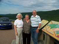

 It rained hard all day Wednesday, so we stayed on the boat and caught up on housekeeping chores and a few small maintenance projects.
Thursday, at about noon the sun came out. We left the marina to see this be
It rained hard all day Wednesday, so we stayed on the boat and caught up on housekeeping chores and a few small maintenance projects.
Thursday, at about noon the sun came out. We left the marina to see this be autiful lake. We anchored on the north shore of West Bay and a secluded cove at the base of the mountains which are the eastern edge of the Cape Breton Highlands.
Friday we took an interesting ride up a narrow chann
autiful lake. We anchored on the north shore of West Bay and a secluded cove at the base of the mountains which are the eastern edge of the Cape Breton Highlands.
Friday we took an interesting ride up a narrow chann el named "The Boom", to Orangedale, an interesting town with a prosperous past. The channel was remonisant of our trip through Georgian Bay in 2007. In Orangedale
  they have resored a late 1800 Railroad Station. In it's heydays, 1930-1950, they had 6 passenger trains and as many as 20 freight trains go through Orangedale every day. Now there are 4 freight trains a week, one each way on Tuesday and Thursdays.
With some windy, rainy weather expected during the night, we snuck into McKin
they have resored a late 1800 Railroad Station. In it's heydays, 1930-1950, they had 6 passenger trains and as many as 20 freight trains go through Orangedale every day. Now there are 4 freight trains a week, one each way on Tuesday and Thursdays.
With some windy, rainy weather expected during the night, we snuck into McKin nens Harbour through a narrow dredged channel. The guide book didn't mention that the channel was schoaling in on the east side, so our trip in got a little interesting. We made it but I was a little concerned as I watched the bottom go by just under the starboard side of the hull. The wind blew 30 K and it rained all day Saturday, so we just hunkered down. Late in the day it calmed down, and I took the dingy back to the narrow channel to take soundings with my lead line to figure out the best course back out. If we hug the west side of the channel we had a good 8' of water.
 Sunday morning we pulled anchor and headed out for Baddeck, with a planned stop in Iona to go see Highland Village, a reconstructed early Scottish village. Iona also has a Government Warf, so we tied up ODYSSEE, got the bikes out, and rode UP to Highland Village. As we were docking, I heard a short squeek of a drive belt, we froze up a bearing on the starboard engine fresh water pump. Yes, we rebuilt the starboard engine, but we used the fresh water pump from the failed engine. So now I have replaced both fresh water pumps, the port engine pum
 p failed a year age at Burlington, VT.
The Village was nicely done, and the view of the lake from on top of the hill was spectacular.
The ride down to h
p failed a year age at Burlington, VT.
The Village was nicely done, and the view of the lake from on top of the hill was spectacular.
The ride down to h ill back to the boat was a whole lot easier than the ride UP. On one engine we proceeded to Baddeck.
Baddeck was Alexander Graham Bell's summer reside
ill back to the boat was a whole lot easier than the ride UP. On one engine we proceeded to Baddeck.
Baddeck was Alexander Graham Bell's summer reside nce, because it was so much like his native Scotland. We visited the museum run by Parks Canada. Most of his experimentation and inventions occured here. Besides the telephone, he is the father of Canadian aviation and the developement of hydrofoil boats, driven by air propellers. His boat, HD-4 set the world speed record on water of 71 MPH in 1919 on Bras d'Or Lakes. This year they are celebrating 100 years of Canadian aviation, in February of 1909 Bell flew his Silver Dart from the ice of Bras d'Or Lakes. More than 100 antique airplanes have flow in to celebrate this occasion.


 Sunday we traveled east, on a beautiful, calm day, around Cape George to Havre Boucher where we anchored in their natural harbor.
  After a very peaceful night, we pulled anchor on Monday morning, heading for Bras d'Or Lakes. We went thru two current control locks, the first in the
 Straights of Canso. This is a large lock capable of handling large ocean going ships. Unlike most locks which raise or lower you several feet, this lock only controls the current through this passage. Depending on the tide, you are either raised or lowered. Today the water level at both ends was vertually equal, so we drove into the lock, held ourselves in the middle
 of the lock, and drove out the other end. The second such lock was as we entered Bras d'Or Lakes at St. Peter. This lake is exposed to tidal water at the north entrance and the St. Peter Canal controls the current at the south end of the lake so boats can safely transit the canal. This is a small lock operated by Parks Canada. Once in the lake we immeadiatly turned left and went to St. Peters Marina operated by the local Lions Club. Two boats we knew from Rimouski were here, including Marcel and Genevieve on their sail boat SANTA MARIA 1. We no more than tied up the boat and Marcel insisted we
  come to their boat for lunch. They had been monitoring their radio and knew when we called into the marina, so were there to greet us. We had a delightful lunch together and then they came over to our boat for a soup supper. Many of the people we meet along the way are special, and
  Marcel and Genevieve are among them.
Tuesday, Marcel and Genevieve took us on a 13 hour driving tour of Cape Breton Islan
Marcel and Genevieve are among them.
Tuesday, Marcel and Genevieve took us on a 13 hour driving tour of Cape Breton Islan d. The highlight of the trip was the drive on the
Cabot Trail, through the Cape Breton Highlands National Park. Around each corner there is another breathtaking vista. The camera just doesn't capture this beauty, but it's the best we have to attempt to share this beautiful scenery with you.
d. The highlight of the trip was the drive on the
Cabot Trail, through the Cape Breton Highlands National Park. Around each corner there is another breathtaking vista. The camera just doesn't capture this beauty, but it's the best we have to attempt to share this beautiful scenery with you.

 It rained hard all day Wednesday, so we stayed on the boat and caught up on housekeeping chores and a few small maintenance projects.
Thursday, at about noon the sun came out. We left the marina to see this be
It rained hard all day Wednesday, so we stayed on the boat and caught up on housekeeping chores and a few small maintenance projects.
Thursday, at about noon the sun came out. We left the marina to see this be autiful lake. We anchored on the north shore of West Bay and a secluded cove at the base of the mountains which are the eastern edge of the Cape Breton Highlands.
Friday we took an interesting ride up a narrow chann
autiful lake. We anchored on the north shore of West Bay and a secluded cove at the base of the mountains which are the eastern edge of the Cape Breton Highlands.
Friday we took an interesting ride up a narrow chann el named "The Boom", to Orangedale, an interesting town with a prosperous past. The channel was remonisant of our trip through Georgian Bay in 2007. In Orangedale
  they have resored a late 1800 Railroad Station. In it's heydays, 1930-1950, they had 6 passenger trains and as many as 20 freight trains go through Orangedale every day. Now there are 4 freight trains a week, one each way on Tuesday and Thursdays.
With some windy, rainy weather expected during the night, we snuck into McKin
they have resored a late 1800 Railroad Station. In it's heydays, 1930-1950, they had 6 passenger trains and as many as 20 freight trains go through Orangedale every day. Now there are 4 freight trains a week, one each way on Tuesday and Thursdays.
With some windy, rainy weather expected during the night, we snuck into McKin nens Harbour through a narrow dredged channel. The guide book didn't mention that the channel was schoaling in on the east side, so our trip in got a little interesting. We made it but I was a little concerned as I watched the bottom go by just under the starboard side of the hull. The wind blew 30 K and it rained all day Saturday, so we just hunkered down. Late in the day it calmed down, and I took the dingy back to the narrow channel to take soundings with my lead line to figure out the best course back out. If we hug the west side of the channel we had a good 8' of water.
 Sunday morning we pulled anchor and headed out for Baddeck, with a planned stop in Iona to go see Highland Village, a reconstructed early Scottish village. Iona also has a Government Warf, so we tied up ODYSSEE, got the bikes out, and rode UP to Highland Village. As we were docking, I heard a short squeek of a drive belt, we froze up a bearing on the starboard engine fresh water pump. Yes, we rebuilt the starboard engine, but we used the fresh water pump from the failed engine. So now I have replaced both fresh water pumps, the port engine pum
 p failed a year age at Burlington, VT.
The Village was nicely done, and the view of the lake from on top of the hill was spectacular.
The ride down to h
p failed a year age at Burlington, VT.
The Village was nicely done, and the view of the lake from on top of the hill was spectacular.
The ride down to h
 ill back to the boat was a whole lot easier than the ride UP. On one engine we proceeded to Baddeck.
Baddeck was Alexander Graham Bell's summer reside
ill back to the boat was a whole lot easier than the ride UP. On one engine we proceeded to Baddeck.
Baddeck was Alexander Graham Bell's summer reside nce, because it was so much like his native Scotland. We visited the museum run by Parks Canada. Most of his experimentation and inventions occured here. Besides the telephone, he is the father of Canadian aviation and the developement of hydrofoil boats, driven by air propellers. His boat, HD-4 set the world speed record on water of 71 MPH in 1919 on Bras d'Or Lakes. This year they are celebrating 100 years of Canadian aviation, in February of 1909 Bell flew his Silver Dart from the ice of Bras d'Or Lakes. More than 100 antique airplanes have flow in to celebrate this occasion.
  We ordered a new water pump from the Detroit dealer in Montreal on Monday morning. It will be here Wednesday about noon. So we are enjoying Baddeck, but look forward to moving on. The new pump arrived at 12:10 on Wednesday, it was installed and we left the marina at 2:30, traveled 15 miles to an anchorage on The Great Bras d'Or behind Otter Island. On the way to The Great Bras d'Or we went past Bell's lake estate. It was at this
location that his aironautical and hydronautical experiments were conducted. The Great Bras d'Or is the NE entrance into Bras d'Or Lakes and is not controlled by a lock. You have to time your exit with the tidal current, which means we have a 6 hour window to go out on Thursday from about 5:00 to 11:00 AM. Well it's Thursday. It's foggy and expected to rain later in the day, and the wind is blowing near 20 Kts. So we are sitting, anticipating a better day tomorrow, if the forcast comes true. We want to see "Bird Islands" just outside and the coast line from here to Louisburg. In  Louisburg, Parks Canada has reconstructed the Fortress of Louisburg, a French Fort which fell to the British in 1745 and again in 1758. It is reconstructed as it was in 1744. This reconstruction is larger than Williamsburg, and our experience with anything Parks Canada does
  has been very well done.
 Louisburg, Parks Canada has reconstructed the Fortress of Louisburg, a French Fort which fell to the British in 1745 and again in 1758. It is reconstructed as it was in 1744. This reconstruction is larger than Williamsburg, and our experience with anything Parks Canada does
  has been very well done.
 We had a nice run to Louisbourg on Friday. We passed under the Great Bras d' Or highway bridge as we headed NE towards the Atlantic. Once outside we detoured a little NW to get to Bird Islands. Not only did we see lots of birds, but large groups of seals were also present.
  Once we turn back to the SE towards the tip of Cape Breton, there was very light wind, a modereate swell, and a very plesant ride. As we rounded the tip of the cape and started back SW we went through our furthest east point, W 059 47.200. At 11;30, the wind started t
 o build from the SW, and as we cleared Main-a-Dieu Passage we met the REAL Atlantic with 6' swells and 3-4' wind waves on top. The only good news was that we were close to Louisbourg so we had only about an hour of rough water as we approached Louisbourg, the Fortress was to our left. When we arrived at the town Warf, we learned they were celebrating their annual Crab Fest, this is a major fishing port for snow crab. On Saturday we spend most of the day at the fortress and were joined by Genevieve and Marcel who drove up from St. Peter and brought Doug and Les on HAPPY CLAMZ with them. It was great to spend lunch with everyone. We went back to town at 5:30 for their crab dinner, only to be disappointed to learn they were sold out, having already served 1500 dinners.
On Sunday, we moved to Canso in 4-6' rolling seas and light wind. passing a few seals along the way. When we arrived we found JUST RELAX was there, looper friends from Charlotte, NC. It blew hard on Monday so we stayed in port. Tuesday, wit h lighter wind, we left for Liscome Lodge, ran all day in dense fog.
It's Thursday, August 6, and we are at Liscomb Lodge. I'm in the Lodge lobby on their Wi-Fi. We've got lots of details to fill in, hope we have good Wi-Fi in Halifax so I can post pictures and details. Weather has not been cooperating. We've had limited windows of opportunity when the waves have been less than 6'. Ran 10 hours from Canso to Liscomb on Tuesday in 4-6' seas and fog with less than 500' visability m
 ost of the day. Liscome Lodge had posted a sign at the end of their dock advising others that might show up that their dock was reserved for two boats, us and JUST RELAX. Wednesday was a lay day waiting for the seas to calm down. Early in the day another Mainship 40 needed a space to find shelter from the rough seas, and called in in hopes of finding a place to tie up. JUST RELAX, also a Mainship 40 agreed to let the other boat raft up to them. We took a walk on one of several hiking trails available on the Lodge property, which went along the opposite shore, allowed us a view of all three boats tied up to the warf. The Lodge is owned by the provincial government and operated by an outside contractor. Seas are dying down now, so we hope to make a two day run to Halifax leaving at about 11:00. Thank you Bill Riley for GPS!

 when the waves have been less than 6'. Ran 10 hours from Canso to Liscomb on Tuesday in 4-6' seas and fog with less than 500' visability m
 ost of the day. Liscome Lodge had posted a sign at the end of their dock advising others that might show up that their dock was reserved for two boats, us and JUST RELAX. Wednesday was a lay day waiting for the seas to calm down. Early in the day another Mainship 40 needed a space to find shelter from the rough seas, and called in in hopes of finding a place to tie up. JUST RELAX, also a Mainship 40 agreed to let the other boat raft up to them. We took a walk on one of several hiking trails available on the Lodge property, which went along the opposite shore, allowed us a view of all three boats tied up to the warf. The Lodge is owned by the provincial government and operated by an outside contractor. Seas are dying down now, so we hope to make a two day run to Halifax leaving at about 11:00. Thank you Bill Riley for GPS!

We left Liscomb Lodge at 11:00 on Thursday, spend the night on the hook in Tangier Harbour. As we left Tangier Friday we passed through a narrow ch annel as we got back out into the deeper water off the coast. We arrived in Halifax at 2:30 on Friday afternoon. We were traveling with two other looper boats and two were here, so we have 5 of the 7 boats doing this trip here together in Halifax. We all had dinner together tonight.


After spending a weekend on the waterfront with the "Busker Festaval" with thousands of people roaming the boardwalk watching all the street acts, and touring all the tourest attractions, we were ready to move on . Monday was forcast to be a day of rain, wind, and fog. We can attest the forecast wa
 s correct. Room became available for us to move down the harbour to Bishop's Landing to join (clockwise) VOYAGER II, HAPPY CLAMZ, and JUST RELAX waiting for better weather. Tuesday was forcast to be a little better, without the wind. With the extra day available we toured Alexander Keith's Brewery.
 . Monday was forcast to be a day of rain, wind, and fog. We can attest the forecast wa
 s correct. Room became available for us to move down the harbour to Bishop's Landing to join (clockwise) VOYAGER II, HAPPY CLAMZ, and JUST RELAX waiting for better weather. Tuesday was forcast to be a little better, without the wind. With the extra day available we toured Alexander Keith's Brewery.
Tuesday morning we left with VOYAGER II, JUST RELAX, HAPPY CLAMZ, and ourselves. The fog was thick, left over swells of 4-6', no wind, and some mist. We could deal wit h this and test the radar and chartplotter one more time. We went into Chester and the others went to Lunenburg. After a nice lunch in Chester we moved to Mahone Bay for the night, tied to a ball in the harbour. Wednesday morning SUMMER ARRIVED. We enjoyed walking around Mahone Bay and then had a beautiful afternoon cruise to Lunenburg where we again met up with the other three boats. We spent one night on an anchorage ball and the second night at a small marina.
 h this and test the radar and chartplotter one more time. We went into Chester and the others went to Lunenburg. After a nice lunch in Chester we moved to Mahone Bay for the night, tied to a ball in the harbour. Wednesday morning SUMMER ARRIVED. We enjoyed walking around Mahone Bay and then had a beautiful afternoon cruise to Lunenburg where we again met up with the other three boats. We spent one night on an anchorage ball and the second night at a small marina.

Like most other coastal Nova Scotia towns, Lunenburg was a cod fishing community. As part of that heritage, Lunenburg was also a great boat building port. Most famous of the boats ever built here was the BLUENOSE. These fishing schooners raced every fall to determine the fastest boat Canadian boat against the fastest American boat. The trophy's they sailed for rivaled the America's cu p. BLUENOSE proved time and again she was the fastest, but as fishing turned to motor powered vessels, it became impossible to k
 eep BLUENOSE going, and she was sold, and ultimately lost at sea. In the early '60's an exact duplicate was built as a private yacht, christianed BLURNOSE II. Ultimately this boat was sold to the Canadian Government for $1.00 and is docked, sailed, and maintained by the Lunenburg Maritime Museum. She has just returned to her home port having participated in the recent tall ship gathering in Halifax. Today, Lunenburg is a tourist attraction, with some wooden boatbuilding and repair still going on.
 p. BLUENOSE proved time and again she was the fastest, but as fishing turned to motor powered vessels, it became impossible to k
 eep BLUENOSE going, and she was sold, and ultimately lost at sea. In the early '60's an exact duplicate was built as a private yacht, christianed BLURNOSE II. Ultimately this boat was sold to the Canadian Government for $1.00 and is docked, sailed, and maintained by the Lunenburg Maritime Museum. She has just returned to her home port having participated in the recent tall ship gathering in Halifax. Today, Lunenburg is a tourist attraction, with some wooden boatbuilding and repair still going on.
On Friday w e set out again and arrived in Shelburne in late afternoon. Some boats
 making this trip amongst the rocks don't fair so well. The Shelburne waterfront was reconstructed for the filming of "The Scarlet Letter". It's neat but there is no tourist trade to bring in enough business to keep the shops open, so this cute little town is falling apart. While we were there, the replica schooner "Amistad" was in port, as it heads south to the Caribean for the winter. This boat was built at Mystic Seaport for the movie "Amistad".
 e set out again and arrived in Shelburne in late afternoon. Some boats
 making this trip amongst the rocks don't fair so well. The Shelburne waterfront was reconstructed for the filming of "The Scarlet Letter". It's neat but there is no tourist trade to bring in enough business to keep the shops open, so this cute little town is falling apart. While we were there, the replica schooner "Amistad" was in port, as it heads south to the Caribean for the winter. This boat was built at Mystic Seaport for the movie "Amistad".
 They have a good fleet of Albacore sail boats  here, and are having the Albacore North American Championship regatta starting on Wednesday, August 19. On Sunday the local fleet had a tune up race, and I sailed one of the sailing school boats with a young girl as my crew. We finished second behind the current Albacore Canadian Champion.
 here, and are having the Albacore North American Championship regatta starting on Wednesday, August 19. On Sunday the local fleet had a tune up race, and I sailed one of the sailing school boats with a young girl as my crew. We finished second behind the current Albacore Canadian Champion.
 On Tuesday we had a good travel day, so the four of us went around the "blueno se" to Yarmouth. Like just about every other day we've been on this coast, we traveled in fog. GPS chartplotter and radar allow us the travel the inside passages in amongst the coastal islands, even in the fog. After spending one night
 se" to Yarmouth. Like just about every other day we've been on this coast, we traveled in fog. GPS chartplotter and radar allow us the travel the inside passages in amongst the coastal islands, even in the fog. After spending one night
  in Yarmouth we crossed St. Mary's bay to the little fishing town of Westport in Grqand Passage. Again
 we had fog all day and the entrance into Grand Passage had currents of at least 5 Kts, creating some
 clanging eddys and a 6' standing wave. Our shelter for the night was behind a government breakwater rafted up to idle lobster boats. When the tide is out lots of beach shows. Note where the permanent fishing warfs are, only accesable at high tide. We went through 18' tides during the night, very interesting.
 From Westport we are off to Saint John, and the Saint John River.
Subscribe to:
Comments (Atom)